Rothesay driving test centre: practice routes and pass rate
C/O Dept. of Employment, 9 King Street, Rothesay, PA20 0DG
Rothesay had a car driving test pass rate of 52% from April 2025 to March 2026 (125 tests), 1.9 points above the average across UK test centres (50.1%). Drive Round App has 3 practice routes around the centre; a typical route is about 27 km, mostly on A roads (64%) and B roads (26%).
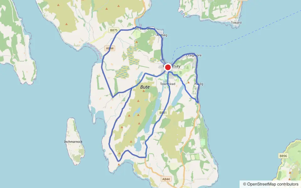
What the practice routes cover
- A roads64%
- B roads26%
- Country lanes7%
- Town and residential roads4%
On a typical route you'll go through 1 roundabouts and 1 sets of traffic lights.
Roads the routes use most
- A8443 of 3 routes
- A844 Ardbeg Road2 of 3 routes
- A844 Argyle Place2 of 3 routes
- A844 Craigmore Road2 of 3 routes
- A844 High Road2 of 3 routes
- A844 Mount Stuart Road2 of 3 routes
- A844 Mountstuart Road2 of 3 routes
- B8782 of 3 routes
Pass rate
From April 2025 to March 2026, 125 car tests were taken at Rothesay and 65 passed: a pass rate of 52%.
Source: DVSA, “Practical car pass rates by gender, month and DTC” (DRT122A). Contains public sector information licensed under the Open Government Licence v3.0.
Practise these routes
Open the 3 Rothesay routes in the app with turn-by-turn navigation, then record your drive and get an AI report on how it went.


These are practice routes built by Drive Round App around the test centre, not official test routes: DVSA doesn't publish its routes, and examiners can use any road in the area. Practise a mix of roads and junctions, not one route. Routes last updated 2 November 2026.